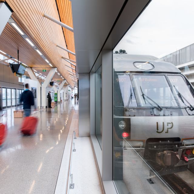
Take the UP Express to the city from the Toronto Pearson International Airport
Getting here
From the airport
Toronto is served by two airports. Toronto Pearson International Airport, managed by the Greater Toronto Airports Authority, is Canada’s principal airport with travel connections to every continent and ranks among the top 30 world airports in terms of passenger traffic and aircraft movements.
Take the UP Express (Union-Pearson Express), a dedicated express rail service connecting Union Station and Toronto Pearson airport, departing every 15 minutes. UP gets you downtown in 25 minutes with free on-board WiFi along the way. The fare is up to $12.35 depending on destination and type of pass. Go to UP Express to find out more.
Billy Bishop Toronto City Airport (formerly Toronto City Centre Airport) is one of the most convenient urban airports in the world. It is located on Toronto Island, minutes from the downtown core with links to the city by a short ferry ride or pedestrian tunnel, and is served by both Porter Airlines and Air Canada.
By train
VIA Rail and AMTRAK bring visitors into the heart of the city each day. Toronto’s Union Station is centrally located downtown and connects to the subway by underground tunnel.
Niagara GO Train is a summer weekend excursion train from Union Station to Niagara Falls with stops in Port Credit, Oakville, Burlington, St. Catharines and Niagara Falls. The ride takes approximately 2 hours from Union station to the Niagara Falls station.
By car
Several highways, including Highways 2, 401, 407 and the Queen Elizabeth Way, link surrounding cities to Toronto. The nearest Canada-U.S. border crossings are at Niagara Falls, Fort Erie and Windsor.
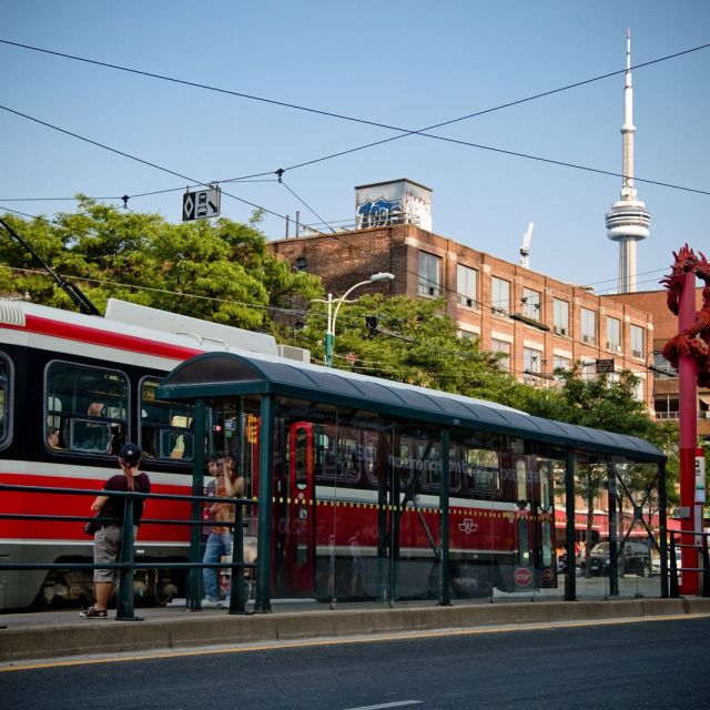
Use the TTC to get around Toronto easily and efficiently
While you're here
Public transit
Explore Toronto on one of North America’s finest transportation systems—the Toronto Transit Commission (TTC). With easy-to-navigate subways, buses and streetcars, getting around the city is a snap. GO Transit is Ontario’s inter-regional bus and train service. It links Toronto with outlying areas of the Greater Toronto and beyond. GO Trains and buses depart from Toronto’s Union Station at regular intervals throughout the day. If you are planning to use public transit, be sure to purchase a PRESTO card, an easy-to-use reloadable payment card that lets you pay your fare on the TTC, GO Transit, UP Express and 8 other transit agencies in Ontario, eliminating the need for tickets, tokens, passes and cash.
Driving around town
- Toronto’s streets follow a basic grid pattern and are easy to navigate.
- Speed limit signs are posted on each street.
- Note that the city’s weekday “rush hour” is more than an hour long—count on heavy traffic from 7:00 a.m. to 9:00 a.m. and again from 4:00 p.m. to 6:00 p.m.
Plenty of Toronto’s major streets have bicycle lanes nearest the curb. Please respect cyclists in the city—they’re environmentally friendly!
Parking
Parking on most downtown streets is limited to specific times of day, and often requires you to purchase and display a ticket from one of the parking machines located along the street. Be sure to check and obey the signs posted along the street to make sure your vehicle doesn’t get ticketed or, worse, towed away. There are also a variety of public parking lots throughout the city. City-owned lots are indicated by the ‘Green P’ logo—a large ‘P’ in a green circle. Plan in advance using Green P’s parking locator to find the nearest lot.
Hail a Taxi, Uber or Lyft
There are a number of different taxi companies in Toronto, including Co-Op Cabs. Ride sharing services Uber and Lyft are available in the city too.
- Taxi fares are standard, metered and non-negotiable
- The driver should start the meter at the beginning of your ride and stop it when you reach your destination
- If your service was acceptable, a 10 to 15% tip is customary
Toronto Island Ferry
Taking a ferry ride in Toronto is a quick and easy way to explore the Toronto Islands. The Toronto Island ferry operates year-round out of Jack Layton Ferry Terminal, located at 9 Queens Quay W., at the intersection of Queens Quay West and Bay Street. Tickets can be purchased online or in-person. The ferry in Toronto carries passengers to and from Centre Island, Hanlan’s Point and Ward’s Island.
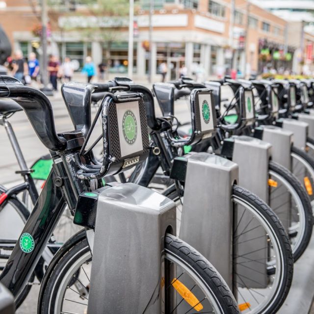
Explore the city by bike using Bike Share Toronto
Biking around town
Biking is one of the best and most efficient ways to explore Toronto. Available year-round, Bike Share Toronto provides a network of public bikes throughout the city. Choose a public bike, or rent one from the many independent bike rental Toronto shops. The Toronto Cycling Map is a great resource and map of the city, showing the 855-km (530 miles) Bikeways Network which includes a combination of off-road paths, bike lanes and shared roadway routes. Plan your own route or check out Toronto's top cycling routes and family-friendly cycling routes, or explore the Toronto Islands by bike.
Walking around town
Toronto is renowned for its safe and easily navigable streets, making it a prime destination for walkers. With numerous walkable neighbourhoods spread across the city, exploring on foot is not only convenient but also the best way to soak in the local culture and atmosphere. From the historic Distillery District to the eclectic Kensington Market, there's something to captivate every walker's interest.